Hiking has become one of the favorite escapes for people living in the United States. Nearly 60 million people took to the trails in 2022, according to Backpacker.com, turning a quiet pastime into the nation’s leading outdoor activity.
Yet as interest grows, so does the appetite for extremes. More hikers are seeking routes that push endurance to its limits, from desert canyons that bake under relentless heat to frozen ridgelines where wind and ice decide who turns back.
Adventure at that level carries serious risks. The National Park Service reports over 300 million park visits each year and an average of 243 deaths on its lands. At the Grand Canyon alone, rangers respond to about 250 rescues annually, most involving heat exhaustion or dehydration. Many underestimate the strain of long climbs, high temperatures, or rapid weather changes.
Still, the draw of challenge remains strong. Once considered niche pursuits, treks like the Grand Canyon’s Rim-to-Rim have become modern badges of toughness and determination, attracting thousands who want to test their limits and see how far grit can carry them.
| Hike/Trail | Location (State & Park) | Distance | Elevation Gain | High Point | Est. Time | Trail Type | Difficulty | Hikers/Year | Injuries/Fatalities |
| Denali (West Buttress) | Alaska – Denali NP | ~31 mi RT (50 km) | ~13,500 ft (4,110 m) | 20,310′ (6,190 m) | 14-21 days | Out-and-back (Glacier) | Extremely Strenuous (mountaineering) | ~1,000 attempts/yr |
>100 deaths (1910s-2020s)
(~50% summit success) |
| Grand Canyon R2R2R | Arizona – Grand Canyon NP | ~42 mi (68 km) | ~11,000 ft (3,350 m) up (21k ft total gain+loss) | 8,200′ (2,500 m) (North Rim) | 1 day (12-20+ hrs) or 2-3 days | Out-and-back (Canyon traverse) | Extremely Strenuous (endurance desert hike) | Thousands (popular ultra-hike) | Hundreds of rescues/yr
; multiple fatalities (heat, falls yearly) |
| Kalalau Trail | Hawaii – Nā Pali Coast SWP | 22 mi RT (35 km) | ~6,000+ ft (1,830+ m) cumulative | ~800′ (~240 m) (coastal cliffs) | 2 days (1-way) | Out-and-back (Coastal) | Strenuous (muddy, exposed) | ~<20k (60 permits/day) | Many injuries; >100 deaths (mostly drownings, some falls) |
| Great Range Traverse | New York – Adirondack HP Wilderness | ~25 mi (40 km) | ~9,000 ft (2,740 m) gain (17,600′ total) | 5,344′ (1,629 m) (Mt. Marcy) | 1 day (12-18h) | Point-to-point (Peaks) | Very Strenuous (rugged ups/downs) | Dozens (few attempt full in 1 day) | Some injuries; fatalities rare (exposure possible) |
| Presidential Traverse | New Hampshire – WMNF (Pres. Range) | ~20-23 mi (32-37 km) | ~8,500-9,000 ft (~2,600 m) total | 6,288′ (1,917 m) (Mt. Washington) | 1 day (10-15h) or 2 days | Point-to-point (Peaks) | Extremely Strenuous (weather, terrain) | Few hundred (1-day finish); many section hikers | >150 deaths (Mt. Washington)
; frequent rescues (25/yr on Mt. Washington) |
| Cactus to Clouds (C2C) | California – San Jacinto Wilderness | ~21 mi RT (34 km) | ~10,300 ft (3,140 m) | 10,834′ (3,302 m) (San Jacinto) | 1 day (10-15h) | Out-and-back or point-to-point (tram) | Extremely Strenuous (steep, heat) | Hundreds (seasonal; many locals) | Multiple rescues yearly (heat, falls)
; several deaths in heat/ice incidents |
| The Maze (Canyonlands) | Utah – Canyonlands NP (Maze Dist.) | ~30+ mi (48+ km) loop | ~3,000-5,000 ft (900-1,520 m) est. | ~6,400′ (1,950 m) (Maze Overlook) | 3-4 days (backpack) | Off-trail loop (canyons) | Strenuous+ (navigation, remote) | Very few (hundreds/year) | No recorded fatalities ; rare SAR for lost hikers |
| John Muir Trail (JMT) | California – Sierra Nevada | 211 mi (340 km) | ~46,700 ft (14,234 m) total | 14,505′ (4,421 m) (Mt. Whitney) | ~20 days (3 weeks) | Point-to-point (Thru-hike) | Strenuous (length, altitude) | ~2,000 (permits limited) | Few deaths (occasional fall); some altitude illness & injuries (SAR as needed) |
| Longs Peak (Keyhole) | Colorado – Rocky Mtn NP | 15 mi RT (24 km)
|
~5,100 ft (1,555 m) gain | 14,259′ (4,346 m) (Longs summit) | 1 day (10-15h) | Out-and-back (Class 3 scramble) | Very Strenuous (altitude, exposed scramble) | ~15k-20k attempts/yr | 71+ deaths since 1880s
; yearly rescues & fatalities (falls, weather) |
| Wonderland Trail | Washington – Mount Rainier NP | 93 mi (150 km) | ~27,000 ft (8,230 m) total | ~6,750′ (2,060 m) (Panhandle Gap) | 9-13 days | Loop trail (circumnavigation) | Strenuous (constant elevation) | ~800-1,000 (permit lottery) | Few injuries; rare fatalities (weather, river crossing) |
1. Denali, Denali National Park (Alaska)
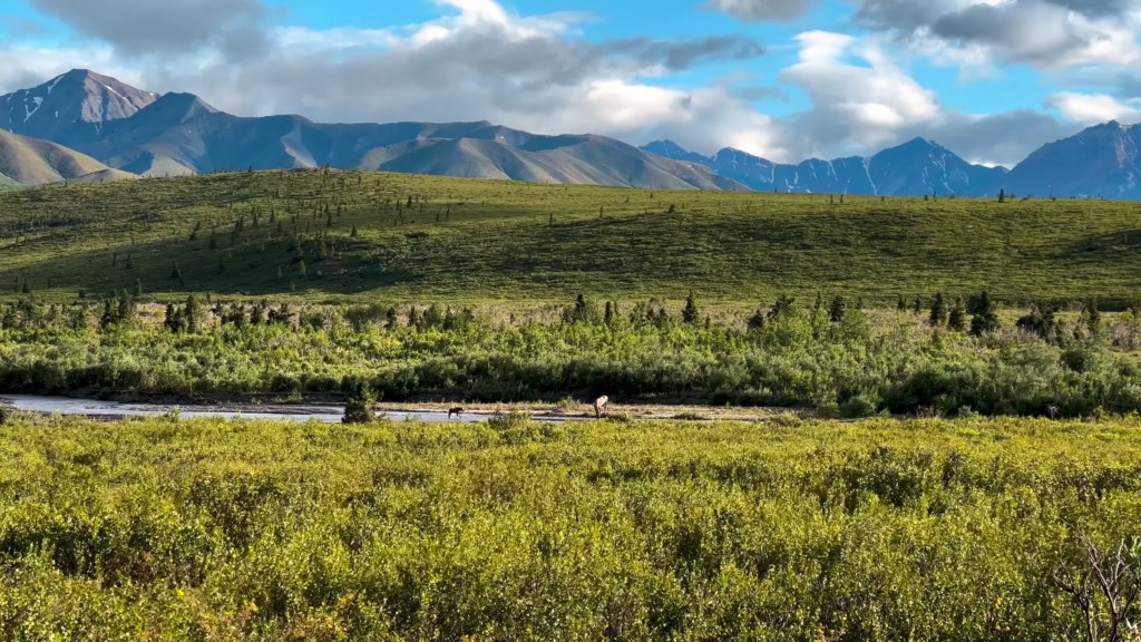
Denali, also known as Mount McKinley, is North America’s highest peak at 20,310 feet (6,190 meters). Unlike a standard hike, climbing Denali is a full-scale mountaineering expedition.
Most climbers take the West Buttress route, which is about 15.5 miles one way (31 miles round-trip) and involves glacier travel, steep snow slopes, and around 13,500 feet of elevation gain. The climb typically takes two to three weeks, with teams hauling heavy gear, setting up high camps, and waiting out dangerous weather.
This route doesn’t involve much technical rock climbing, but it does require serious alpine skills like crevasse rescue, high-altitude fitness, and winter survival. Conditions are harsh – temperatures can drop below -40°F, and the mountain’s remote location (about 100 miles from the nearest road) makes rescue operations difficult.
Only about half of those who attempt Denali’s summit succeed, and over 100 climbers have died on the mountain over the past century.
| Location | Alaska (Denali National Park & Preserve) |
| Distance | ~31 miles round-trip (via West Buttress) |
| Elevation Gain | ~13,500 feet (4,100 meters) |
| Highest Elevation | 20,310 feet (6,190 meters) |
| Estimated Time | 2-3 weeks (expedition style) |
| Trail Type | Out-and-back (glaciated mountaineering route) |
| Difficulty | Extremely strenuous; requires alpine skills |
| Hikers per Year | ~1,000 climbers attempt annually; ~50% reach the summit |
| Injuries/Fatalities | Over 100 deaths (mostly from falls, avalanches, altitude illness) |
With oxygen levels at the summit about half of sea level, extreme cold, unpredictable storms, and the need to haul ~100 lbs of gear, it’s one of the most physically demanding routes in the U.S. Success requires serious training, acclimatization, and preparation.
Rescue support is limited, so self-reliance is essential.
2. Grand Canyon Rim-to-Rim-to-Rim (R2R2R), Arizona
The Rim-to-Rim-to-Rim hike is one of the most intense endurance hikes in the U.S., taking hikers from the South Rim of the Grand Canyon to the North Rim and back again, twice crossing the full depth of the canyon.
The shortest version of the route (via South Kaibab to North Kaibab and back via Bright Angel or South Kaibab) is about 42 miles round-trip, with over 21,000 feet of total elevation change.
Most attempt it as a single-day ultra hike or run, taking 12 to 20+ hours. Others spread it over 2-3 days with an overnight backpacking permit. It’s not a technical trail, but it is extremely strenuous due to steep climbs, extreme temperatures, and long mileage.
The hike drops from ~7,000 ft at the South Rim to 2,400 ft at the Colorado River, climbs to ~8,200 ft at the North Rim, and repeats in reverse, which means you’re gaining over a vertical mile on the way back.
Summer heat, especially in the inner canyon, can exceed 110°F (43°C), and medical incidents are common. Grand Canyon rescue teams respond to hundreds of emergencies each year, and heat-related illnesses and occasional fatalities are a recurring issue.
While challenging, the trail will also offer amazing sights and nature, such as various types of cactuses, including Saguaro. Just be sure not to accidentally damage one, as that is illegal in Arizona.
| Location | Arizona (Grand Canyon National Park) |
| Distance | ~42 miles (67 km) round-trip |
| Elevation Gain | ~11,000 feet up; ~21,000 ft cumulative gain/loss |
| Lowest/Highest Points | ~2,400 ft (Colorado River) / ~8,200 ft (North Rim) |
| Estimated Time | 12-20+ hours (1-day push) or 2-3 days (backpacking) |
| Trail Type | Out-and-back (South Rim to North Rim and return via corridor trails) |
| Difficulty | Extremely strenuous (long distance, steep climbs, heat exposure) |
| Hikers per Year | Thousands (rim-to-rim); growing R2R2R popularity (no official total) |
| Injuries/Fatalities | ~250 rescues/year; multiple deaths some years (heat, falls, cardiac events) |
Conditions vary wildly – you can start in freezing temps at the rim and face desert heat hours later. Water availability is limited in parts of the route, and many hikers underestimate the effort required. The physical and mental toll of the back-to-back canyon crossings makes this one of the toughest endurance hikes in the country.
3. Kalalau Trail, Nā Pali Coast, Kauai, Hawaii
View this post on Instagram
The Kalalau Trail runs 11 miles along Kauai’s rugged Nā Pali Coast, from Keʻe Beach to Kalalau Beach, making it a 22-mile out-and-back hike. While the highest point is only around 800 feet above sea level, the constant steep ascents and descents add up to over 6,000 feet of cumulative elevation gain.
Most hikers complete it in 2-3 days, camping overnight at Kalalau Beach or Hanakoa Valley.
The trail is known for its beauty and its dangers. It’s narrow, often muddy, and hugs cliffs above the ocean. Notorious sections like Crawler’s Ledge offer little room for error. Flash floods, slippery footing, and drop-offs pose serious hazards.
Permits are required for overnight camping, and both overnight and day use are capped daily. Fatalities have occurred from falls and drownings, and rescues are not uncommon, especially during bad weather.
| Location | Kauai, Hawaii (Nā Pali Coast State Wilderness Park) |
| Distance | 22 miles round-trip (35 km) |
| Elevation Gain | ~6,000+ feet cumulative (≈1,800 m) |
| Highest Elevation | ~800 feet along coastal ridges |
| Estimated Time | 2-3+ days (out-and-back) |
| Trail Type | Out-and-back (narrow coastal singletrack) |
| Difficulty | Strenuous (steep, muddy, exposed cliffs, tropical conditions) |
| Hikers per Year | <20,000 (60 overnight permits/day; 900/day limit for first 2 miles) |
| Injuries/Fatalities | Dozens of deaths in the area (falls, drownings); frequent rescues and injuries |
Water crossings can become dangerous without warning, and there’s no resupply or early exit once you’re committed. Heavy packs, tropical heat, and narrow trail conditions push endurance and focus. While the scenery is spectacular, reaching Kalalau Beach and returning safely takes serious preparation and caution.
4. Great Range Traverse, Adirondack High Peaks, New York
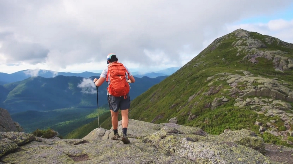
The Great Range Traverse is one of the toughest hikes in the Northeast, covering about 25 miles point-to-point through New York’s High Peaks Wilderness. The route typically starts at Adirondack Loj, summits Mount Marcy (New York’s highest peak at 5,344 ft), and continues across a series of major peaks, including Haystack, Basin, Saddleback, Gothics, Armstrong, and the Wolfjaws, ending near Keene Valley.
In total, the hike involves around 9,000 feet of elevation gain and over 17,000 feet of cumulative elevation change. Most hikers aim to complete it in a single day, starting before dawn and hiking for 12 to 18+ hours.
While there’s no technical climbing, the trails are rough, steep, and often muddy, with rock scrambles and exposed sections. Water is scarce on the ridgelines, and the weather can turn quickly.
The route has no formal bailout options once committed, making this a serious endurance and logistical challenge. While many hikers tackle parts of the range, only a small number complete the full Traverse in one push each year.
| Location | Adirondack High Peaks, New York (High Peaks Wilderness) |
| Distance | ~25 miles (40 km) point-to-point |
| Elevation Gain | ~9,000 feet up; ~17,600 ft total gain/loss |
| Highest Summit | Mount Marcy – 5,344 ft (1,629 m) |
| Estimated Time | 12-18 hours (1 day); sometimes done in 2 days |
| Trail Type | Point-to-point traverse (no bailout routes mid-hike) |
| Difficulty | Very strenuous – steep, rugged terrain, constant elevation change |
| Hikers per Year | Dozens complete full traverse annually; more hike sections individually |
| Injuries/Fatalities | Occasional injuries; no well-documented deaths on Traverse itself |
The hike starts with the highest summit and continues through increasingly tough terrain, including Saddleback’s cliff scramble and the long push to Haystack. Water is hard to come by, and hikers must carry enough or know where to refill.
Weather, exposure, and the psychological strain of relentless climbing make this one of the hardest endurance hikes in the East. Those who complete it earn serious respect in the Adirondack hiking community.
5. Presidential Traverse, White Mountains, New Hampshire
@lydialoo121 💅💅presidential traverse vlog💅💅 #whitemountains #presidentialtraverse #hikingvlogs #mountainvlogs #newhampshiretiktok #newenglandfall ♬ original sound – lydia keating
The Presidential Traverse is a classic challenge in New England, covering the major summits of New Hampshire’s Presidential Range. The standard route crosses 7-8 named peaks, including Mount Washington (6,288 ft), with options to add more. It spans roughly 20 to 23 miles point-to-point with 8,500 to 9,000 feet of elevation gain, usually hiked from the Appalachian Trailhead to Crawford Notch.
Many complete it in a single long day (10-15 hours), while others opt for a 2-day version with an overnight at a hut or campsite. Terrain is extremely rough, especially above treeline, and the weather on Mount Washington is notoriously unpredictable; wind, fog, and cold can occur even in summer. The trail involves constant elevation change, rock scrambling, and long exposed sections.
Though thousands hike the individual peaks each year, only a few hundred attempt the full Traverse annually. Mount Washington alone averages over 25 rescues per year and has recorded more than 150 fatalities since the 1800s.
| Location | White Mountain National Forest, New Hampshire |
| Distance | ~20-23 miles (32-37 km) |
| Elevation Gain | ~8,500-9,000 feet (≈2,600-2,750 m) |
| Highest Summit | Mount Washington – 6,288 ft (1,917 m) |
| Estimated Time | 10-15 hours (1 day) or 2 days with overnight |
| Trail Type | Point-to-point traverse over alpine summits |
| Difficulty | Extremely strenuous – rugged terrain, steep climbs, extreme weather |
| Hikers per Year | Hundreds complete full traverses; thousands hike individual peaks annually |
| Injuries/Fatalities | >150 deaths on Mount Washington; ~25+ rescues/year on that peak alone |
The terrain is rocky and uneven, requiring constant attention and strong stabilizer muscles. Fatigue builds as you summit peak after peak with little reprieve. Mount Washington’s unpredictable weather adds serious risk; sudden temperature drops, high winds, and fog are common even in midsummer.
Proper planning, gear, and caution are essential. Despite the difficulty, it’s one of the most iconic hikes in the Northeast, offering panoramic views and a rewarding test of endurance and mountain sense.
6. Cactus to Clouds (C2C), Mount San Jacinto, California
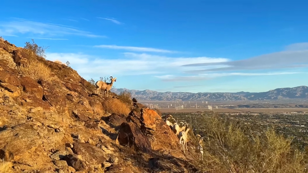
Cactus to Clouds is one of the toughest day hikes in the U.S., known for its extreme vertical gain. Starting from Palm Springs at about 500 feet elevation, the route climbs over 10,300 feet to the 10,834-foot summit of Mount San Jacinto, all in one continuous push.
The full hike is roughly 21 miles round-trip, though many hikers take the tram down from Long Valley (~8,500 ft) after summiting, reducing the total distance.
The trail is brutally steep, especially the first 10-mile Skyline segment, which has no water, no shade, and gains 8,000 feet before joining the upper San Jacinto trail.
Due to extreme heat, the route is considered unsafe in summer and was temporarily closed by the state in 2024 after multiple rescues and a fatality.
C2C is popular with SoCal endurance hikers, but only a few hundred likely complete it each year. Even in cooler seasons, hikers must start before dawn and carry multiple liters of water. Injuries, rescues, and heat-related incidents are frequent.
| Location | Palm Springs, CA to Mt. San Jacinto (San Jacinto Wilderness) |
| Distance | ~21 miles round-trip (~34 km); ~16 miles one-way (with tram descent) |
| Elevation Gain | ~10,300 feet (3,140 m) |
| Highest Elevation | 10,834 ft (3,302 m) – Mt. San Jacinto summit |
| Estimated Time | 10-15 hours (1 day); typical start time is 2-4 AM |
| Trail Type | Point-to-point or out-and-back (tram descent common) |
| Difficulty | Extremely strenuous – steep climb, heat exposure, altitude |
| Hikers per Year | A few hundred (mostly experienced local hikers) |
| Injuries/Fatalities | Multiple rescues yearly; several deaths from heat/falls in recent years |
Many hikers run out of water before reaching Long Valley. Heat is a major hazard; even spring temps can exceed 90°F, and in summer it’s deadly. The final stretch to the summit adds more elevation and often includes snow or icy sections.
Fatigue, altitude, and trail confusion have led to many rescues. Completing C2C requires serious fitness, smart pacing, early starts, and proper planning. It’s a true endurance test with major consequences for mistakes, and a huge reward for those who finish.
7. The Maze, Canyonlands National Park, Utah
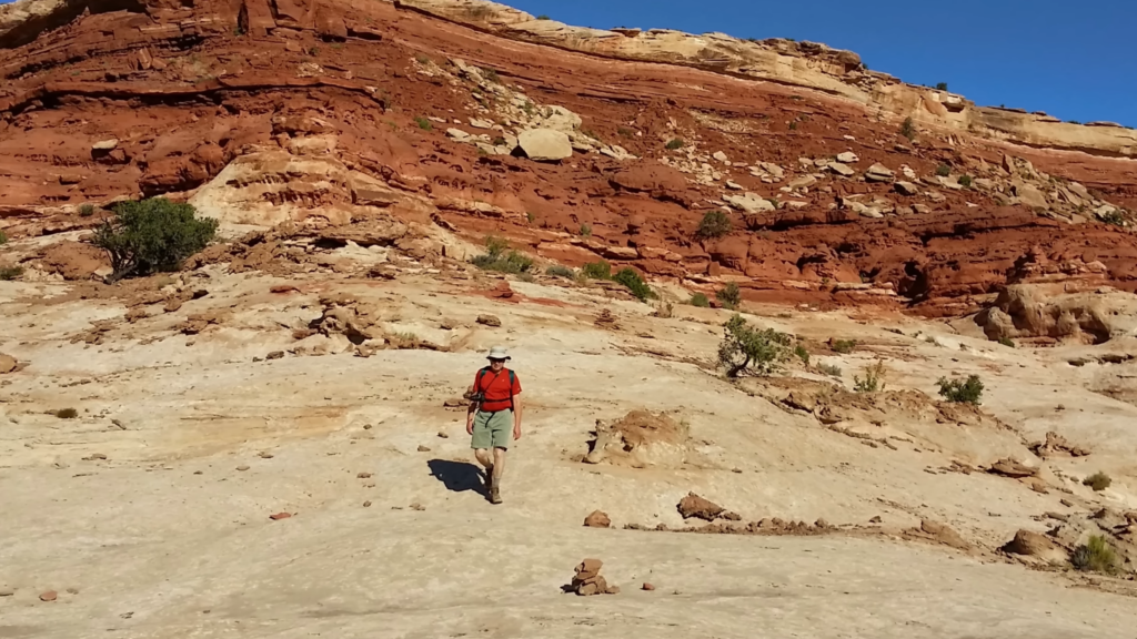
The Maze District of Canyonlands is one of the most remote and challenging hiking areas in the U.S. There are no marked trails, just a network of rugged, twisting canyons requiring advanced navigation skills.
A typical hiking loop covers around 30 miles over 3-4 days, often starting from the Maze Overlook and looping through landmarks like the Chocolate Drops, the Land of Standing Rocks, and the Harvest Scene.
While the mileage may seem moderate, the route-finding, scrambling, and heat make it extremely strenuous. Elevation gain adds up as you climb in and out of canyons (some 500-1,000 ft deep), and temperatures in summer can exceed 110°F. There are virtually no water sources, so hikers must cache water or rely on known springs.
This area sees very little foot traffic, only a few hundred hikers per year, and the risks are significant. Navigation errors, dehydration, and isolation are the biggest dangers. The National Park Service warns that even experienced hikers can get lost.
Even for experienced hikers, preparation can make or break a safe journey, especially in remote environments where help may be days away. From heat illness to minor injuries, carrying essential supplies isn’t optional.
That’s why keeping your first aid kit refills up to date is just as critical as your map or water supply. In places like The Maze, you won’t have the luxury of quick assistance, so every piece of gear matters.
| Location | Canyonlands National Park, Utah (Maze District) |
| Distance | ~30+ miles (48 km) for a typical loop; many variations |
| Elevation Gain | ~3,000-5,000 feet cumulative |
| Highest/Lowest Point | Maze Overlook ~6,400 ft / Canyon floors ~4,000 ft |
| Estimated Time | 3-4 days backpacking |
| Trail Type | Off-trail route-finding through canyon systems |
| Difficulty | Very strenuous – navigation, scrambling, desert exposure |
| Hikers per Year | A few hundred (the entire Maze District sees ~2,000 visitors/year) |
| Injuries/Fatalities | No confirmed fatalities (as of 2021); rare rescues for lost or dehydrated hikers |
Hikers must be confident with maps and compasses to avoid getting trapped in dead-end canyons. The remoteness is absolute: you may not see another person for days, and any injury or error could lead to a serious emergency.
With no water sources, extreme heat, and difficult terrain, The Maze demands planning, skill, and total self-reliance. It’s one of the few places in the continental U.S. where isolation is total and mistakes can be costly.
8. John Muir Trail, California Sierra Nevada
View this post on Instagram
The John Muir Trail is a 211-mile backcountry route through the Sierra Nevada, running from Yosemite Valley to the summit of Mount Whitney. It’s one of the most challenging long-distance hikes in the U.S. due to its sustained elevation, repeated climbs, and overall duration.
The trail crosses 11 major mountain passes, many above 11,000 feet, and ends at 14,505 feet, the highest point in the lower 48.
Most hikers take about 3 weeks to complete the JMT, averaging 10-12 miles per day. While the trail itself is well-built and non-technical, the daily elevation gains (3,000-4,000 ft), altitude, and remoteness make it a serious physical and logistical challenge.
Hikers must plan for resupplies, carry all backcountry gear, and manage risks like altitude sickness, weather, and fatigue. Permits are capped, and demand is high.
| Location | California Sierra Nevada (Yosemite to Mount Whitney) |
| Distance | 211 miles (340 km) |
| Elevation Gain | ~46,700 feet total (14,234 m) |
| Highest Elevation | 14,505 ft (4,421 m) – Mount Whitney |
| Estimated Time | ~20 days (3 weeks average) |
| Trail Type | Point-to-point thru-hike (well-maintained backcountry trail) |
| Difficulty | Strenuous – high altitude, long duration, major climbs |
| Hikers per Year | Estimated 1,500-3,000 completions/year (permit-limited) |
| Injuries/Fatalities | Occasional rescues (altitude illness, injuries); few fatalities overall |
Weather can change quickly, especially at higher passes, and resupply points are few and far between, meaning hikers may carry up to 9-10 days of food at once. Despite the well-maintained trail, the cumulative strain makes it one of the hardest non-technical backpacking trips in the U.S.
Those who finish it often call it the most rewarding hike of their life, but also one of the most exhausting.
9. Longs Peak, Keyhole Route, Colorado
Longs Peak is one of Colorado’s most iconic and dangerous 14ers. The standard route, the Keyhole Route, is a 15-mile round-trip hike gaining over 5,100 feet from the trailhead to the summit at 14,259 feet. While it’s non-technical, the final stretch involves exposed Class 3 scrambling with real fall risk.
The route begins as a strenuous hike to the Boulder Field, then climbs through the Keyhole and across several steep sections, the Ledges, the Trough, the Narrows, and the Homestretch, where hands are required for balance.
A misstep in these areas can be fatal. The summit push typically takes 10-15 hours round-trip and requires a very early start (usually 2-4 AM) to avoid afternoon thunderstorms, which are frequent and deadly.
Despite the risks, 15,000-20,000 people attempt the hike each year. Only a fraction summit due to weather, exhaustion, or turning back at the Keyhole. Longs has claimed over 70 lives since 1884 and sees multiple rescues annually.
| Location | Rocky Mountain National Park, Colorado |
| Distance | ~15 miles round-trip (24 km) |
| Elevation Gain | ~5,100 feet (1,554 m) |
| Highest Elevation | 14,259 ft (4,346 m) – Longs Peak summit |
| Estimated Time | 10-15 hours (start before 4 AM advised) |
| Trail Type | Out-and-back; final 1 mile is Class 3 scramble |
| Difficulty | Very strenuous – high altitude, exposure, scrambling |
| Hikers per Year | ~15,000-20,000 attempts annually; ~3,000-5,000 summit (est.) |
| Injuries/Fatalities | 71+ deaths since 1884; frequent rescues (falls, altitude, weather) |
Afternoon storms are a major risk; lightning, hail, and cold can hit suddenly. A late descent can be dangerous, and the park recommends being off the summit by noon. The trailhead signage warns: “Beyond this point, rescue may be impossible.”
With its mix of physical, mental, and environmental challenges, Longs is not just a hike; it’s an alpine ascent that requires serious preparation, caution, and respect.
10. Wonderland Trail, Mount Rainier, Washington
The Wonderland Trail is a 93-mile loop that fully circles Mount Rainier, gaining around 27,000 feet of elevation over the course. It’s one of the most physically demanding long-distance backpacking routes in the U.S. due to its constant elevation change, daily mileage with a heavy pack, and variable mountain weather.
Most hikers complete it in 9-13 days, staying at pre-reserved campsites. While the trail is well-maintained and marked, the up-and-down profile is relentless, climbing in and out of deep river valleys every day. The route passes through old-growth forests, alpine meadows, and high ridges with glacier views, offering stunning scenery at every turn.
Permits are limited and assigned via lottery, making access competitive. Hazards include swollen river crossings, hypothermia from cold, wet weather, and fatigue from multi-day strain. Fatal incidents are rare, but rescues happen each season for injuries or weather-related issues.
| Location | Mount Rainier National Park, Washington |
| Distance | 93 miles (150 km) – full loop |
| Elevation Gain | ~27,000 feet cumulative (8,230 m) |
| Highest Elevation | ~6,750 ft at Panhandle Gap |
| Estimated Time | 9-13 days (average ~10 days) |
| Trail Type | Loop trail circumnavigating Mount Rainier |
| Difficulty | Strenuous – constant elevation gain/loss, long duration, heavy packs |
| Hikers per Year | ~900+ complete full loop per year (permit-limited) |
| Injuries/Fatalities | Occasional injuries; rare fatal events (weather, river crossings) |
While the Wonderland Trail is considered the most demanding long-distance route around Mount Rainier, the northern part of the state also offers shorter but equally scenic adventures. Many hikers explore options featured in our Whatcom County hiking guide.
Rainier’s massive presence affects everything, from local weather to trail conditions. You’ll cross glacial rivers, climb steep ridges, and hike long miles to reach your next assigned camp.
While not as high as some alpine routes, the accumulated effort is massive, and the remote setting demands full self-sufficiency. The reward? A rare chance to walk a complete circle around one of America’s most iconic volcanoes.
The Bottom Line
Extreme routes across the United States demand more than muscle or gear. Every climb, canyon, and ridgeline forces a reckoning with judgment, restraint, and endurance. The country’s most dangerous hikes reward those who respect limits and punish those who gamble on luck.
Rangers say the same thing every season: nature never negotiates. Each person who reaches the trailhead carries the full cost of the choices made out there, and survival always begins long before the first step.
If you prefer not so demanding places for hiking that are still offering amazing sights, check out the Kings Canyon National Park.
