San Bernardino County is huge. It covers almost 20,105 square miles in Southern California, making it the biggest county in the United States.
It is so large that nine full states are smaller than it. You can drive for hours and still be inside the same county.
The land includes busy cities, quiet deserts, and tall mountain ranges. Many people have no idea how huge it really is until they see how far it spreads across the map.
How Big Can a County Get
San Bernardino County` is so big that it almost feels unreal. Covering over 20,000 square miles, it is officially the biggest county in the United States.
To put that in perspective, it is larger than nine U.S. states and even bigger than countries like Switzerland and Costa Rica.
When people hear that, they usually stop and check the number twice.
The True Scale of San Bernardino County
| Total Area | 20,105 square miles |
| East-West Distance | Around 215 miles |
| North-South Distance | About 140 miles |
| Elevation Range | 480 ft (Needles) to 11,503 ft (Mount San Gorgonio) |
| Desert Coverage | About two-thirds of the total land area |
| National Parks and Forests | Joshua Tree National Park, Mojave National Preserve, San Bernardino National Forest |
| Incorporated Cities | 24 |
| Major Highways | I-10, I-15, I-40, Route 66 |
A County That Could Be Its Own State
Imagine starting a drive near the Nevada border and heading west toward Los Angeles. Hours go by. You pass desert towns, wide stretches of open land, and snow-topped peaks in the distance, and you still have not left San Bernardino County.
That’s how massive it is. It takes nearly four hours to cross it from end to end.
A Land of Big Contrasts
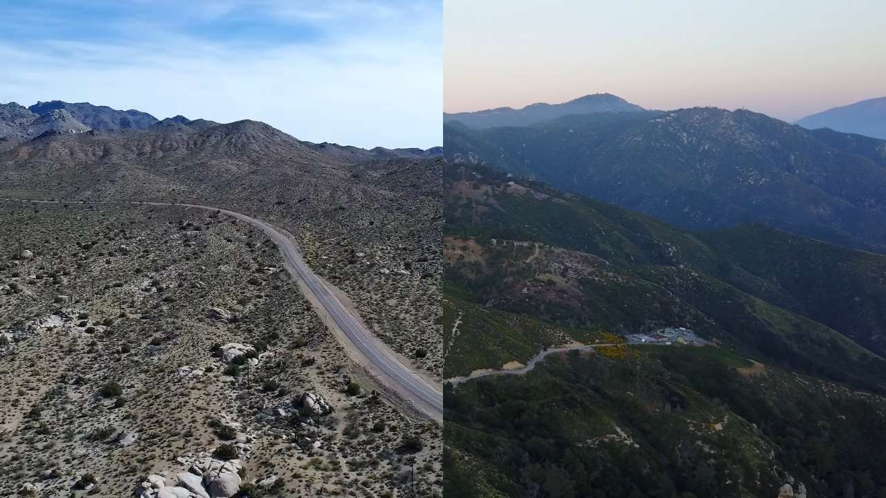
The land shifts fast. The Mojave Desert burns in the east, while forests cover the San Bernardino Mountains to the west.
One side holds scorching dunes and dry valleys; the other side sees snow each winter. Inside this single county sit cities like Ontario, Victorville, and Rancho Cucamonga, along with quiet desert communities that feel a world apart.
Size That Shapes Daily Life
That size creates real challenges for locals. The county government has to manage everything from large city streets to remote desert roads.
Services, schools, and law enforcement all stretch over thousands of square miles. It is a place where urban life, wilderness, and empty desert all exist within one line on a map.
San Bernardino County proves that the word “county” can mean something much bigger than most people imagine.
The Nine States That San Bernardino County Outranks in Size

| State | Total Area (square miles) | How It Compares |
|---|---|---|
| Rhode Island | 1,545 | Over 13 times smaller |
| Delaware | 2,489 | Over 8 times smaller |
| Connecticut | 5,543 | Almost 4 times smaller |
| New Jersey | 8,723 | More than double smaller |
| New Hampshire | 9,349 | Less than half the size |
| Vermont | 9,616 | Less than half the size |
| Massachusetts | 10,554 | About half the size |
| Hawaii | 10,932 | Nearly half the size |
| Maryland | 12,407 | Roughly 60% of the county’s area |
San Bernardino County does not just edge out small states. It dwarfs them. Its total area of 20,105 square miles is so vast that each of those nine states fits inside it with plenty of room left over.
Rhode Island, the smallest state in the nation, could fit inside San Bernardino County more than thirteen times. Even Maryland, which holds big cities like Baltimore, would still be swallowed up by its borders.
A Map That Puts It in Perspective
If you placed San Bernardino County over the East Coast, its edges would stretch from New York City down to Washington, D.C. That kind of distance shows how unreal its size truly is.
The entire state of New Jersey would disappear inside it, and there would still be space for parts of Pennsylvania.
The Reason for Its Massive Scale
The unusually large size came through old boundary decisions made when California was still being divided in the 1800s. The state had huge open lands, and much of the Mojave Desert had few settlers.
The Top 10 Biggest Counties in the United States
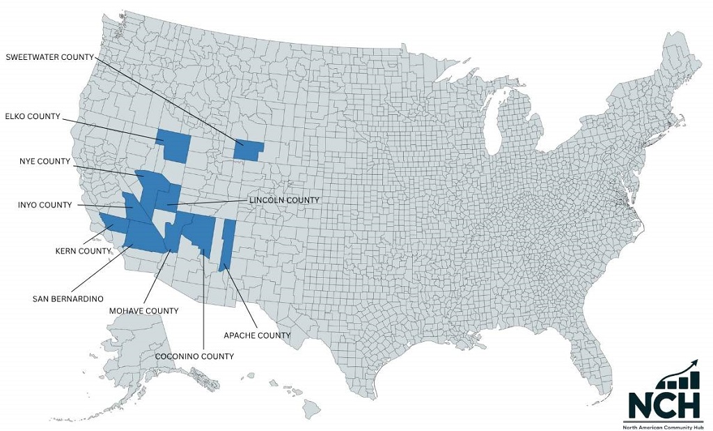
| Rank | County | State | Total Area (square miles) | Quick Fact |
|---|---|---|---|---|
| 1 | San Bernardino County | California | 20,105 | Bigger than 9 U.S. states |
| 2 | Coconino County | Arizona | 18,661 | Home to parts of the Grand Canyon |
| 3 | Nye County | Nevada | 18,147 | Larger than Massachusetts |
| 4 | Elko County | Nevada | 17,203 | Borders Idaho and Utah |
| 5 | Mohave County | Arizona | 13,461 | Includes part of the Colorado River |
| 6 | Apache County | Arizona | 11,218 | Known for vast Native American lands |
| 7 | Inyo County | California | 10,227 | Contains Mount Whitney, the highest point in the contiguous U.S. |
| 8 | Lincoln County | Nevada | 10,637 | Covers parts of the Great Basin Desert |
| 9 | Sweetwater County | Wyoming | 10,491 | Rich in natural gas and open plains |
| 10 | Kern County | California | 8,163 | California’s oil and agriculture hub |
San Bernardino County, Coconino County, and Nye County together cover almost three times the size of Indiana. Yet combined, they have a population smaller than many mid-sized cities.
Final Thoughts
San Bernardino County proves how massive one place can be. Its land, history, and people show the scale of the American West better than any map could. Big numbers tell part of the story, but standing there and seeing that open space tells the rest.